Last week I commented the up-coming agricultural reform in Switzerland, see http://catherinepfeifer.blogspot.com/2012/09/what-went-wrong-with-swiss-agricultural.html. On Wednesday, the reform was accepted by the parliament. There will not be any subsidy per animal anymore, but the subsidy will be area based. Expected impact of this policy change is to reduce the over production of milk and meat.
Clearly the farmers who have invested in modern livestock farm and who need to pay back their credit will be the looser, the low-input farmers the winners.
As a compromise, the parliament increase money that is made available to the agricultural sector. The amount of subsidy stays the same. The additional money should be made available in form of credits to allow farmers to transit in the new system. I wonder if this will really help the farmer who already has taken up a lot of credit and who is stuck in an industrialized agriculture...
Switzerland now has definitely a more sustainability oriented agricultural policy, that still provides the highest support to farmers in Europe. I am curious to see how the Swiss agricultural sector will adjust!
More info under :
http://www.tagesschau.sf.tv/Nachrichten/Archiv/2012/09/26/Schweiz/Session/Agrarpolitik-2014-17-Keine-Tierbeitraege-aber-mehr-Geld
Friday, September 28, 2012


Sunday, September 23, 2012
What went wrong with the Swiss agricultural policy?
Last week has been a hot week in the Swiss parliament. The agricultural policy revision was on the agenda.
There is no doubt, the agricultural sector Europe wide has been liberalized despite of the still very high level of subsidies (in Switzerland more then 60% of the farmer's income comes through subsidies) Milk quotas have been abolished, barriers to trade are continuously decreased. What is the effect of this market liberalization? Farmers faced low prices and therefore started to produce more pushing prices even lower. Today Switzerland produces more milk and sugar beets then ever.
On the top of this, Swiss agricultural policies are still based the idea of industrialization of agriculture (a policy that emerged after World War II to insure food security) and gives incentives to farmers to produce even more.
Today's debate is about making agricultural policies that do not support industrialization anymore and that focus on much more sustainable production. The total amount paid to the agricultural sector should remain at the same level, but the distribution of the money will become different. The subsidy per animal for example should be abolished.
In principle a low input agriculture would allow to produce high quality food for the Swiss and European market. This type of agriculture would be much more sustainable.
The farmer in this movie explains how he organized his low input system. He makes use of nature and his animals to reduce mechanization. His cows are grazing on the meadow. Compared to an intensive system, he does not need to carry the grass to the farm nor to bring the manure back saving on fuel for the tractor and reducing the CO2 emission. Thanks to grazing land management, he has the right amount and quality of grass when needed, and his cows produce about 30 liters of milk per day which within the average without using soya (that is one of the major reason for deforestation) or other fodder than produced on his farm.
He also has a small amount of pigs he feeds with input produced on his farm at zero cost. The stable is organized in such a way that animal warmth stays within and no electricity for heating is possible. Again saving money and improve sustainability.
When the new policy comes, he will be a winner, with his low input system, he will get more subsidies for his environmentally friendly production.
All in whole, the new policy setting incentives for more a more sustainable agriculture. It sets the incentive for a more traditional (opposed to industrialized production) which corresponds to what society wants. Less production will also restore normal prices allowing all farmers to benefit.
So why all these discussions for something that looks so optimal and urgent? Many "model farmers" who were praised years ago as innovative because they invested into a modern and industrialized agriculture are going to loose. They have invested in more machine, bigger stables and are today trapped. They need to pay back the credits that enabled them to mechanize and industrialize their production. It is understandable that those farmers that have followed the policies and strategy of the government now stand up and refuse to loose. Therefore, the change towards low input agriculture should be slow, allowing to farmers to adjust.
This movie is an interesting interview with the the president of the Swiss farmer organization, debating if the new policy will increase or decrease the farmers' income. For sure is only that the new subsidy scheme will change the distribution, and there will be losers and winners.
Next week the debate will continue in the parliament. It's going to be a hot week in Bern !
There is no doubt, the agricultural sector Europe wide has been liberalized despite of the still very high level of subsidies (in Switzerland more then 60% of the farmer's income comes through subsidies) Milk quotas have been abolished, barriers to trade are continuously decreased. What is the effect of this market liberalization? Farmers faced low prices and therefore started to produce more pushing prices even lower. Today Switzerland produces more milk and sugar beets then ever.
On the top of this, Swiss agricultural policies are still based the idea of industrialization of agriculture (a policy that emerged after World War II to insure food security) and gives incentives to farmers to produce even more.
Today's debate is about making agricultural policies that do not support industrialization anymore and that focus on much more sustainable production. The total amount paid to the agricultural sector should remain at the same level, but the distribution of the money will become different. The subsidy per animal for example should be abolished.
In principle a low input agriculture would allow to produce high quality food for the Swiss and European market. This type of agriculture would be much more sustainable.
The farmer in this movie explains how he organized his low input system. He makes use of nature and his animals to reduce mechanization. His cows are grazing on the meadow. Compared to an intensive system, he does not need to carry the grass to the farm nor to bring the manure back saving on fuel for the tractor and reducing the CO2 emission. Thanks to grazing land management, he has the right amount and quality of grass when needed, and his cows produce about 30 liters of milk per day which within the average without using soya (that is one of the major reason for deforestation) or other fodder than produced on his farm.
He also has a small amount of pigs he feeds with input produced on his farm at zero cost. The stable is organized in such a way that animal warmth stays within and no electricity for heating is possible. Again saving money and improve sustainability.
When the new policy comes, he will be a winner, with his low input system, he will get more subsidies for his environmentally friendly production.
All in whole, the new policy setting incentives for more a more sustainable agriculture. It sets the incentive for a more traditional (opposed to industrialized production) which corresponds to what society wants. Less production will also restore normal prices allowing all farmers to benefit.
So why all these discussions for something that looks so optimal and urgent? Many "model farmers" who were praised years ago as innovative because they invested into a modern and industrialized agriculture are going to loose. They have invested in more machine, bigger stables and are today trapped. They need to pay back the credits that enabled them to mechanize and industrialize their production. It is understandable that those farmers that have followed the policies and strategy of the government now stand up and refuse to loose. Therefore, the change towards low input agriculture should be slow, allowing to farmers to adjust.
This movie is an interesting interview with the the president of the Swiss farmer organization, debating if the new policy will increase or decrease the farmers' income. For sure is only that the new subsidy scheme will change the distribution, and there will be losers and winners.
Next week the debate will continue in the parliament. It's going to be a hot week in Bern !
Monday, September 17, 2012
Human made nature? The story of Rieselfelder nature conservation area
During the Geostat meeting (http://catherinepfeifer.blogspot.com/2012/09/is-there-such-thing-as-free-lunch.html), an excursion to the
Rieselfelder area a meadow bird conservation area near Muenster was organized.
It is one of these areas where human have accidentally shaped a landscape that
turned out to conserve nature. A nice example of how unexpected rural areas
developments shape the current European rural landscape.
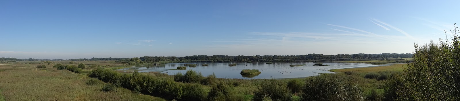 |
| The major and regulation pond |
Rieselfelder used to be shaped by sewage farming. Beginning
of the century, the waste water of Muenster were directed to Rieselfelder,
where the waste water was used to fertilize the land. As the city of Muenster
grew, more and more waste water was directed to the area and farming became
impossible in the middle of the century. Only in the late seventies the city of
Muenster put an waste water plant into operation. In the meantime, waste water
continued flowing into the abandoned Rieselfelder area. The waste water laid
there and create small ponds full of mud and prevented tree and shrubs to grow.
The openness of the landscape and also the nutritious mud attracted many meadow
birds who found there the peace for breeding and abundant food, in a time where
these types of landscape disappeared from the European map.
 |
| A smaller pond |
Today, after several attempt to transform the Rieselfelder
area into an industrial zone, it finally became a nature conservation area
under the European bird directive. It is formed of several ponds with rids
where meadow bird find the safety and silence to breed. The recycled water from
the waste water plant flows into the biggest pond, that also serves as a
reservoir. During the summer, the water from the reservoir is used to fill the
other small ponds making sure that the area stays wet enough. The decreasing
level of water in the reservoir during this period results in a bigger muddy
zones, which insures that the meadow bird find sufficient food during the
breeding time.
 |
| The regulation point of the major pond/reservoir |
The whole area has also been well planned for recreation and
attracts the city dwellers who less than 10 km from the town center find a
place to relax, without disturbing the breeding meadow birds. Also the biological
field station offers children program so that every child regardless of her/his
background can discover nature. The biological field station also maintains the
area with some employees and many volunteers and collect data about meadow
birds.

It is an interesting story showing that the lack of urban
planning has created an environment that on other location has disappeared and
has become today one of the crucial nodes in Europe for migrating birds : a
multifunctional landscape worth a visit and some thoughts about the human
nature interaction.
More info can be found under http://www.rieselfelder-muenster.de/
 |
| Our very engaged and passionate guide |
Tuesday, September 11, 2012
Is there such a thing as a free lunch? a reflection on open source GIS
An ArcGIS software license cost about 1400$ per year per
computer. Despite of its high cost, it is the most used software for mapping
and geo-data analysis. In developing countries, this is an unbearable cost and
most GIS specialists work with pirated software. It is a matter of time until
ESRI (the company that distributes the ArcGIS software) will start suing
organization lacking legal in licenses even in developing countries (something that
already happens in the developed world).
Open source software offer a free alternative to the ESRI
products (http://catherinepfeifer.blogspot.ch/2011/08/desperate-need-for-more-geographical.html). Open source software is
software which code is freely available and therefore any modification of the
code has to be shared freely. User and developer communities work together in
developing the software thanks to forums, wiki and meetings. In short, it is
nonprofit software.
Last week I joint the Geostat 2012 in Muenster, Germany (http://www.geostat-course.org/Muenster_2012). It is the European summer school (All classes have
been recorded and can be streamed on the geostat website) followed by the
meeting of the developers for open source GIS. It was for me the occasion to
familiarize myself with the latest development in open source GIS (not yet
released code), in spatial analysis, but also to
familiarize myself with the existing open source GIS software (the stable
version) and make up my mind about their usefulness in a developing world
context, where users often have only very little GIS background.
 |
| participants testing out some R code |
During the week I discovered how to use R (the open source
version of Matlab, a statistical program) as GIS, Grass and Saga (both open
source GIS). R is a relatively low level programing language, which needs initial
investment to learn the coding language. Its spatial base package (SP developed
by trainers of the summer school) and a whole other range of spatial package
offer an amazing range of option to analyses spatial data. Visualization of
data is feasible but reminds far behind the easy and good looking options given
by ESRI. Also after one afternoon of programing with some R freaks, we did not
manage to read and overlay two of my own maps L
(mainly because projections and extend have to match). The most recent code
development allow to link R with google earth for visualization, including the
spatio-temporal visualizations. Other code recently developed or in development
allow for spatio-temporal data analysis and data dissagragation (downscaling).
Grass is an open source software that has been initially
developed for linux, but it is made compatible to all other operating systems
and even got a relatively nice graphical user interface (GUI). It stays that
the most efficient way to work with this software is to use the command window
like with R. Unfortunately the nice options, such as easy copy paste, the
automatic protocoling of work done, and the function history which allows to
recall all the commands ever applied on a dataset are features that only work
in the linux version, leaving the Microsoft user in a much less efficient
environment. Also the graphical representation of data, the ease to change
legends, colors and titles is relatively clumsy. Nonetheless, Grass comes with
a set of amazing feature that the ArcGIS software will only offers years from
now and probably at high costs. Among others Grass includes a new algorithm to
compute water flow and therefore delineate basin without using the tradition
“fill sink” opens, amazing 3D visualizations (available on Arc for an
additional 3800 $ license), an up-coming spatio-temporal analysis tool (I have
never worked this this type of data, I don’t really know what Arc offers, but I
guess the base license will never allow manage spatio-temporal data so
efficiently), terrain analysis tool and for the upcoming Grass 7 (to be
released probably in about a year) will come with a tool that allows to compare
two maps by swiping over it (an amazing visualization tool that will allow to
show stakeholders in an easy way different spatial alternatives.)
 |
| The GRASS 6.3 GUI |
Similarly SAGA GIS offers a whole range of tools, 3D visualizations
and terrain(working with point clouds) that are incomparable to what Arc
offers. Saga runs directly without installation from any external storage
devise. The GUI is smartly organized and once the logics of it is well
understood, allows to perform manipulations efficiently. But here again the
layout options are very limited and it is difficult to come up with maps that
looks as good as those easily produced in ArcGIS.
Both Grass and Saga can be linked to R, allowing to combine
the statistical power of R with GIS tools and algorithm developed by the open
source GIS software.
 |
| A SAGA 3D visualization of Innsbruck |
In the developing world, the first objective is to train people
to make simple geo-data analysis, to represent graphically geodata without
great theoretical background. The open source options I have discovered last
week require users that understand geographical data very well (no projections
on the fly like in Arc), the layout options for producing good looking maps are
limited, and often the GUIs are not as user friendly that the one from ArcGIS. None
of the program I have seen really convinced me as an alternative of Arc GIS for
stakeholders in the developing world. Other open source software exist that
might mimic the Arc GIS option in terms of visualization, such as MapWindow or
Qgis. It might be worth to look into these options.
The open source options nonetheless have convinced me as a
scientist. Today, I combine stata, excel and ArcGIS, copy manually values, run
simulation almost manually. If I make a mistake somewhere, it takes days to
rerun. In principle all could be programmed with one R code that calls for data
and routines with it owns suite of packages but also those from the open source
software. It would decrease source of errors and allow to rerun code quickly in
case of mistake. Also open source comes with a community of developer that
support user and love to take up the challenges brought up by users. Therefore,
features and tools might be up-coming faster than with ESRI.
 |
| Tom and Gerard, two lecturers (and organizers) from Wageningen University |
Definitely, there is no such a thing as a free lunch. Open
source GIS comes with amazing computational options and GIS analysis for free,
with an amazing community of support full of very nice people. But it comes
with relatively high cost. It is a relatively steep learning curve for reaching
a decent level of programming language. It needs a lot of patience to adjust
the settings of one’s computer to make the software run, especially for
Microsoft users who need to learn how to trick their system, and accept that
some fancy stuff is simply not possible, because one cannot change the
Microsoft code. It is definitely not what a stakeholder who wants to produce
some simple map in the developing world is looking for. I guess one needs to
hide a little nerd in one’s heart to take up the open source challenge …
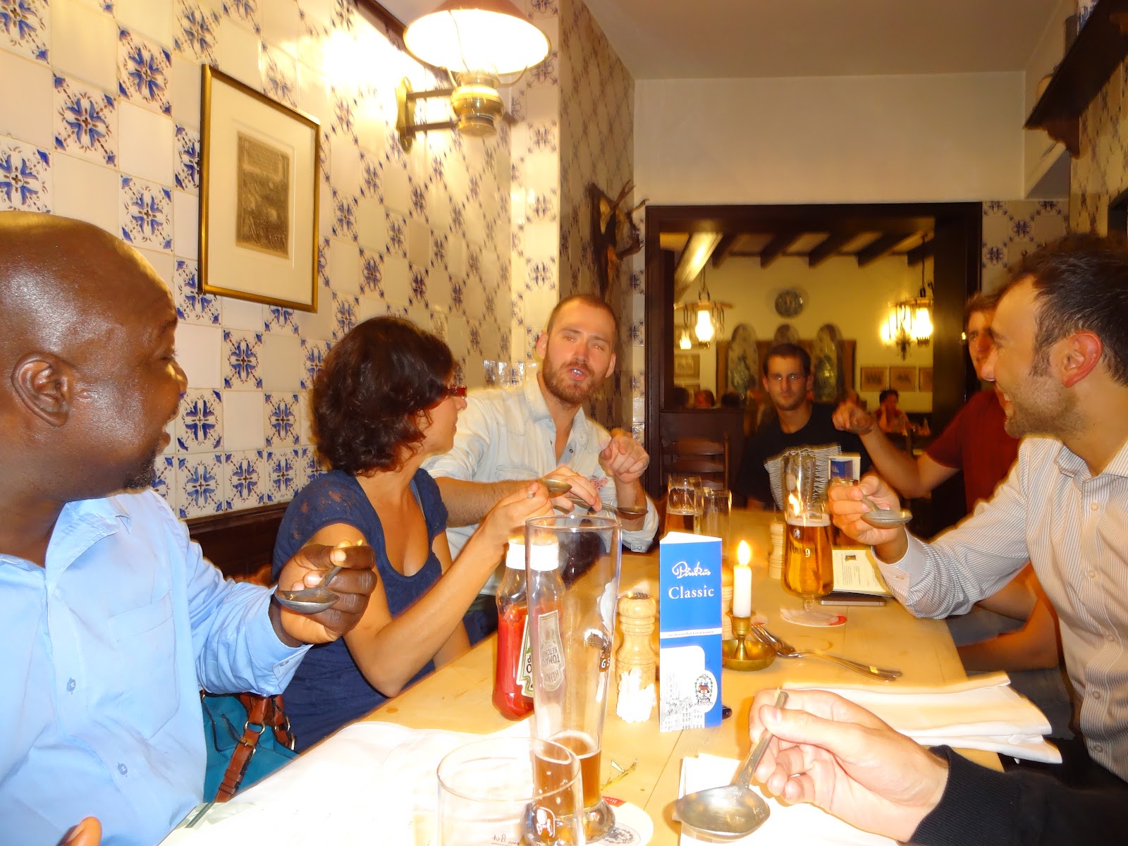 |
| one of the social evenings with beers and sausages |
Finally, I had a very good week. Not only did I learn about
recent developments in open source GIS, but also that computer programmer are
not autistic nerds with no social life. On the contrary, I met amazingly
interesting, sociable and funny people. I would like to thank the organizer for
the very smooth organization, for the trainers for sharing their passion and
all the participants for the support and patience when my R was again sending
an error message and for all the nice social evenings…
Tuesday, August 28, 2012
Groundwater in Ethiopia: Features, Numbers and Opportunities
Groundwater has a huge potential increasing resilience and incomes of the rural poor in Africa. Indeed it gives the possibility to smallholders to access water during the dry season and maintain home gardens (http://catherinepfeifer.blogspot.ch/2012/06/success-and-failures-maksenit-watershed.html), adding a cropping season or insure sufficient drinking water for the household and livestock.
Unfortunately very few data are available about groundwater in Africa and more particularly in Ethiopia. The recent global African map by MacDonald et al 2012 (http://catherinepfeifer.blogspot.ch/2012/04/accessing-ground-water-is-easiest-way.html) is a good step but remains relatively non detailed. Seifu Kebebe a researcher from Addis Ababa University, has looked into more details into groundwater in Ethiopia and has just published a book about it.
 This book obviously fills a huge gap for water management in Ethiopia!
More about this book and be found under the following links :
http://www.amazon.co.uk/Groundwater-Ethiopia-Features-Opportunities-Hydrogeology/dp/3642303900#reader_3642303900
http://www.springer.com/earth+sciences+and+geography/hydrogeology/book/978-3-642-30390-6
The International Water Management Institute in Addis Ababa, per courtesy of Seifu has access the groundwater maps presented in the book. Please contact the GIS team or myself for more information about these maps and conditions of access.
Unfortunately very few data are available about groundwater in Africa and more particularly in Ethiopia. The recent global African map by MacDonald et al 2012 (http://catherinepfeifer.blogspot.ch/2012/04/accessing-ground-water-is-easiest-way.html) is a good step but remains relatively non detailed. Seifu Kebebe a researcher from Addis Ababa University, has looked into more details into groundwater in Ethiopia and has just published a book about it.

More about this book and be found under the following links :
http://www.amazon.co.uk/Groundwater-Ethiopia-Features-Opportunities-Hydrogeology/dp/3642303900#reader_3642303900
http://www.springer.com/earth+sciences+and+geography/hydrogeology/book/978-3-642-30390-6
The International Water Management Institute in Addis Ababa, per courtesy of Seifu has access the groundwater maps presented in the book. Please contact the GIS team or myself for more information about these maps and conditions of access.
Wednesday, August 22, 2012
are we going to face a global food crisis?
What are will the consequences of the American drought on the world food prices? and how will this impact on the poor?
A good report from Aljazeera :
A good report from Aljazeera :
Thursday, August 16, 2012
Modern traditions : todays livestock transhumance in Swiss Alps
Livestock transhumance has a long tradition in the Swiss Alps. Livestock moves from the valley bottom slowly upwards to the Alps at the beginning of the summer. As fodder is consumed, the livestock moves further upwards. When fodder is consumed on the highest location, or when first snow starts falling, the livestock moves downwards, and somewhere end of September is back at the valley bottom. In order to not carry milk down to the valley, it is transformed into cheese on the Alp. Often there is no electricity in the Alps and therefore cheese is produced manually, without milking machine and using fire to heat up the milk.
Bringing the livestock to the Alps is therefore time and cost intensive in a world where intensive livestock production implies an industrialized production using imported soja or maize as fodder in a system where most of the cows never see the sky.
Nonetheless the tradition of transhumance in Switzerland still exists, and i met a farmer near Davos who showed me how the tradition has been modernized and industrialized.
Nowadays, there are mobile milking machines or milking wagons that make use of a generator for getting the electricity. With the installation i visited, 10 cows can be milked simultaneously. It takes about one hour to milk the 50 cows. The milk is directly transferred to a cooling container.
The farmer does not live in the Alps anymore. Thanks to the good road he can come with is car every morning and evening. He also carries back the milk to the Valley where it will be processed into cheese. Because Alp milk has a special taste and gives particularly good cheese, the milk from the Alps is processed separately to produce Alp cheese, which can be sold above the average cheese price.
To make it more profitable 6 farmers decided to work together and bring 200 cows of which 50 are dairy cows to the Alps and are managed by one. These dairy cows give an average of 15 litter milk per day and are fed on the alpine grass only.
Great to see that even very old traditions can be maintained and modernized!
 |
| Sertigtaal, near Davos, Switzerland |
 |
| Grazing cows in the Sertigtaal near Davos |
Nowadays, there are mobile milking machines or milking wagons that make use of a generator for getting the electricity. With the installation i visited, 10 cows can be milked simultaneously. It takes about one hour to milk the 50 cows. The milk is directly transferred to a cooling container.
 |
| the mobile milking installation (milking wagon) for 5 cows, two of them are in use |
 |
| the milking wagon from the side, the farmers stands in between the two "milking wagon" where the cows are standing for getting milked |
The farmer does not live in the Alps anymore. Thanks to the good road he can come with is car every morning and evening. He also carries back the milk to the Valley where it will be processed into cheese. Because Alp milk has a special taste and gives particularly good cheese, the milk from the Alps is processed separately to produce Alp cheese, which can be sold above the average cheese price.
 |
| in front the tank to bring the milk to the Valley, in the the back the generator |
To make it more profitable 6 farmers decided to work together and bring 200 cows of which 50 are dairy cows to the Alps and are managed by one. These dairy cows give an average of 15 litter milk per day and are fed on the alpine grass only.
 |
| the generator and the fuel tank |
Great to see that even very old traditions can be maintained and modernized!
Saturday, August 11, 2012
What's the future for GPSs?
GPS have changed how we collected data. Nowadays, all farm household surveys are geo-referrenced (coordinates of the farm) allowing to locate precisely the location. With the increasingly available geographical layers farm data can be related to bio-physical conditions, such a soil, rainfall, proximity to road, ...
Also GPS have taken over our lifes, most new mobile phones have one, most of the people in the developed world orients herself with a TomTom.
What is the future of this technology? and what are the risk? how to tick your GPS? Here some answers :
Also GPS have taken over our lifes, most new mobile phones have one, most of the people in the developed world orients herself with a TomTom.
What is the future of this technology? and what are the risk? how to tick your GPS? Here some answers :
Monday, August 6, 2012
benefit sharing mechanisms in the Blue Nile Basin
These are my last hours in office before my home leave, the occasion to clean up and close down everything. A recent look at my drafts on my blog reminded me that since last November I wanted to write a post on benefit sharing mechanisms in the Blue Nile. Somehow i never wrote this post that now fit very well the topic as my last post was about payment for ecosystem services for Kenyan pastoralists (http://catherinepfeifer.blogspot.com/2012/08/benefit-sharing-mechanisms-kenyan.html) .
During my field trip in November, we went to Hamusit (Amhara region, near Tana Lake), and we visit a dam, which water is used downstream for an irrigation scheme.
 |
| Dam near Hamusit |
The watershed was one of the best managed watersheds I had ever seen in Ethiopia. Everywhere soil and stone bunds could be found. All the bund were vegetative bunds, upon which beans where growing. As bean are nitrogen binding they improve soil fertility. The whole plant can also be fed to livestock, that get more protein rich fodder and therefore will give more milk. Also inter-cropping could be found, maize was planted with beans.
 | ||||
| the stone bunds |
Fascinated by this very well managed watershed, i asked my Amharic speaking colleague to talk to a farmer passing by. We discovered that the people who are profiting from the irrigation schemes, come upstream for about 20 days to help the upstream farmers to build and maintain the bunds. The farmer explained that if the watershed is not well managed than siltation of the lake (created with the dam) will be too important and the capacity of the water reservoir will decrease. As the farmers downstream are the one who profit from having more water in the reservoir so they have to dedicate some of their time working on the fields of the up-stream farmers.
 |
| the vegetative soil bunds |
By digging further it turned out that this was a governmental scheme organized by the DA that obliged farmers downstream to contribute to the up-stream farmers.
Whether is is smart to have a top-down approach or not, is beyond the discussion here. Fact is that the farmers who benefit from better up-stream management contribute the up-stream management of the watershed. This is nothing else that a benefit sharing mechanism, which does not make use of cash payment but takes the form of labor exchange.
This benefit sharing mechanism in Hamusit made me rethink the mass mobilization program of Ethiopia. This program mobilizes all farmers in one regions during a certain amount of days, during which they have the obligation to build bunds and terraces for free, independently of the ownership of the land. The objective is to get the whole watershed well managed, and help farmers who own land on the slope to build the right structures.
Bunds and terraces will increase infiltration of water, conserve soil moisture and decrease run-off. Downstream farmers on the lowland will have more water as form of groundwater or river thanks to these structures. As the lowland is usually flat, there farmers do not need to build the labor intensive terraces and can benefit from structure built upstream. So is the Ethiopian mass mobilization not a form of benefit sharing mechanism, which aknowledges that the benefit might be diffuse and cannot be quantified for each farmer separately?
Food for thoughts when talking of benefit sharing mechanism... it is not always about money... and it can take unexpected forms...
Subscribe to:
Posts (Atom)