My recent trips to the Philippines made me discover a new part of the world but also opened my eyes on natural disasters. In the Philippines, one should live far from the beach because of the tsunami, somewhere is the valleys to be protected from typhoons, but also not too near to the rivers to avoid flooding. Not talking of earth quake which could happen everywhere... So one is left with living on the slope of a volcano, which activity seems at least for now to be minor :-S.
I just found an interesting video from Aljazeera on the effect of natural disaster on the economy : It discusses that the problem is not only the extreme event, but the effect of the event is much bigger due to the lack of natural resource management such as forests in rural area. Furthermore urbanization leads more people to cities. The poor have to move to the areas where cheaper land which is located in higher risk zones. As the poor also live more densely, a disaster will touch more people and the poorer ones...
Have a look at this interesting movie!
http://aje.me/RoHyjM
Saturday, March 16, 2013


Friday, March 8, 2013
Women's day : is empowering women a mission impossible?
The 8th of March is Women's day, a day made to reflect on the position of women in the world. Last year I have shown the women I had met in rural Ethiopia and how they live (see http://catherinepfeifer.blogspot.ch/2012/03/8th-of-march-international-womens-day.html). Often they do very hard work, have very little power in their families and social environment. But not all is bad, even in Ethiopia you can find women that are slowly making their way or in rural communities or the agricultural sector and get more and more their voices heart. Today I would like to introduce you to some of these women who somehow impressed me and are part of a change.
Firstly, last year I coordinated focus group discussions in 4 communities in Ethiopia (see http://catherinepfeifer.blogspot.ch/2012/06/giving-rural-communities-voice-adapting.html), and we worked with women separately so that their voice could be heart. Some of these women never had a pen in their hand and first were afraid to draw the map and to even say something.
But along the discussion, most women started feeling more comfortable, started talking and even tried to take a pen and draw or use the glue. They discovered that they are in fact capable of doing many things, but they simply had never tried before. They also discovered that their opinion was valuable to us, and not just the one of their husbands. At the end of the exercise women presented their work to the men's group. I was impressed how these women managed to defend their work, when men started to criticize, something most of them had not done before.
But it is not only about getting women into expressing their opinions in community discussions but it is also about getting more women in trainings and pushing them to gain experience. We tried to involve women into the moderation of focus group discussions. For all of them it was their first moderation exercise, they were already so much more sure of themselves for the second round... so hopefully not it was not their the last one.
Also we tried to get women into all the trainings, with more or less of success. Like in the western world, it is very difficult to find women working in engineering or ict.
Also, during the GIS training, some of the class was taught by the Ethiopian female GIS specialist of IWMI, who after giving the class once became a good teacher.
 |
| Women presenting their work in Gorosole watershed |
 |
| Women working on a participatory mapping exercise in Maksegnit |
 |
| Women presenting their work in Shambu |
 |
| training the female moderator for the focus group discussions |
 |
| The only Ethiopian female participant in a training for water practitioners |
 |
| The GIS training with the female participants on the left, and the female GIS specialist second from the right |
I also once had an Ethiopian intern who was very shy. It took energy and training. But when she left she gave such a breath taking presentation of her work, sure of herself and ready to defend her work.
 |
| The Ethiopian women's run last year with the Ethiopian intern |
I am impressed by all these women, who all have made a big step given the situation there are in. They all show us that in fact, it does not take so much to empower women. Far from being a mission impossible, it was just a matter of giving to each of these woman the chance to do something she had never done before and giving her the possibility to grow. So why doesn't it happen more often?
Monday, March 4, 2013
A stop to urban sprawl in Switzerland
This week end, the Swiss population accepted among others the new land use law. The new law aims at limiting urban sprawl by freezing the amount of development areas for the next twenty years. The basic principle behind it is to limit the areas that are converted from agricultural land into urban land, but increasing the density within the urban areas.
Indeed, in Switzerland, local zoning plan define how densely a certain area can be build by fixing the percentage of square meter a construction is allowed to cover, as well as a maximum volume that can be built on a plot. Sometimes also the maximum of floors are fixed. On paper it is relatively easy to change these values and allow new and bigger constructions.
See the a short history of urbanization of Switzerland (by Swiss TV in German)
But is it really so easy? if the intensification does not take place, then Switzerland will be lacking in housing capacity and the already high rents might go up. I am now living near to one of these areas where the intensification potential is already there. Some investor bought villas with big gardens, and wanted to build more intense, with flats. This is exactly what the new land use law is expecting. But the project never took place, because the population stood up and wanted to keep the historical picture of the town... so the success of this law will depend on our capacity to let old constructions go and get more modern buildings.
The most interesting part of the new law is its new financial tools coming with it. A new tax will be perceived on land that has been reclassified from agricultural land to urban. This allows to raise money for developing infrastructure in rural areas and landscape (or paying out the people for the plots that would be reassigned from urban to agriculture). A great financial tool that was already discussed a lot in the Netherlands during my PhD time.
I am looking forward to see how this law will be implemented!
Indeed, in Switzerland, local zoning plan define how densely a certain area can be build by fixing the percentage of square meter a construction is allowed to cover, as well as a maximum volume that can be built on a plot. Sometimes also the maximum of floors are fixed. On paper it is relatively easy to change these values and allow new and bigger constructions.
See the a short history of urbanization of Switzerland (by Swiss TV in German)
But is it really so easy? if the intensification does not take place, then Switzerland will be lacking in housing capacity and the already high rents might go up. I am now living near to one of these areas where the intensification potential is already there. Some investor bought villas with big gardens, and wanted to build more intense, with flats. This is exactly what the new land use law is expecting. But the project never took place, because the population stood up and wanted to keep the historical picture of the town... so the success of this law will depend on our capacity to let old constructions go and get more modern buildings.
The most interesting part of the new law is its new financial tools coming with it. A new tax will be perceived on land that has been reclassified from agricultural land to urban. This allows to raise money for developing infrastructure in rural areas and landscape (or paying out the people for the plots that would be reassigned from urban to agriculture). A great financial tool that was already discussed a lot in the Netherlands during my PhD time.
I am looking forward to see how this law will be implemented!
Wednesday, February 27, 2013
The politics of global food security
Recently, Inside Story, an Aljazeera program looked into how food security will change with climate change. It discusses an UN as well as a CGIAR report that predict that staple food production will decrease in many developing countries as a result of climate change.
The discussions suggests,that politics plays a key role in promoting new more climate resistant crops could allows to slower the trend of decreasing staple food production. Also land grabbing and speculation on food could play a key role in high staple food price and should be regulated to reverse the trend.
Have a look at this interesting program, that includes an interview from my former colleague at ILRI!
Aljazeera summarize as follows the main facts about global food security :
The discussions suggests,that politics plays a key role in promoting new more climate resistant crops could allows to slower the trend of decreasing staple food production. Also land grabbing and speculation on food could play a key role in high staple food price and should be regulated to reverse the trend.
Have a look at this interesting program, that includes an interview from my former colleague at ILRI!
Aljazeera summarize as follows the main facts about global food security :
- According to a UN commissioned report, by 2050, the crop yields of wheat could fall by 13 per cent and rice by 15 per cent
- Scientists say yam, barley, millet and lentils may become new staples as these crops can withstand harsh weather conditions
- Scientists say adopting new crops could be a cultural challenge
- Agricultural systems will struggle to feed nine to10 billion people by 2050
- The report predicts that the cost of feeding livestock will become more expensive
- Climate change could also affect the intensity of crop pests and diseases
- Scientists are trying to develop heat and drought resistant crops
- The report calls for global investment in more sustainable agriculture and recommends allocating more funding for agricultural research
Monday, February 18, 2013
Look beyond rice : livelihoods in Ifugao region
In my previous blog posts on agriculture in the jungle and rice , we discovered that Ifugao people
produce rice in the famous Banaue rice terraces to insure food security, as
well as a set of rainfed vegetable which are sold and therefore are cash
generating. Next to this, smallholders in the area have many different
activities to insure the resilience of their livelihoods. Next to their houses they have a home garden with vegetables that
can be irrigated when needed, such as cabbage, carrot or paksoi and another very common vegetable from the pumpkin family which name I could not memorize as well as fruits such as papaya. Also all the
farms had in average about 20 chickens that run around freely. Both vegetables
and the eggs are home consumed and sold. I have also seem many farmer
keeping wild pigs for the pork meat. Fish and shells for the rice fields are
mainly for home consumption.
Next to the houses one can also find nut trees, which red
nuts are chewed with tobacco and shell powder. This combination has narcotic
effects and is taken by almost all young people. The nuts are therefore for
many people a significant source of income.
 |
| the nut trees |
The jungle also offers a whole range of benefits. The
privately own forest seemed to my non-expert eyes pretty sustainably managed.
Trees are cut mainly for building houses or for carving furniture and souvenirs
for tourists.
 |
| The papaya trees around the houses |
Off-farm options exist, mainly thank to tourism also offers
a whole range of opportunities, young people become tour guides and some older
wealthy people build guesthouses. Nonetheless, in the todays setting tourism
only benefits a few and not really the community as a whole. An indirect effect
is that the people who work in tourism will hire other smallholders to maintain
their farms and harvest rice. A male daily laborer get about 500 pesos (12,5
dollars) a day for maintaining the terraces, female daily laborer get about 150
pesos a day for weeding. In comparison, a server/cleaner in a fast food chain
in Manila makes about 300 pesos a day. So working on someone else’s rice field
does not seem such a bad business, just very tiresome.
I tried to understand how the community was organized,
whether they had informal or formal institutions that would bind them to each
other, but I could not find any, not even the Church. Definitely, I yet do not understand how these communities are organized. It is a pretty different setting that the one I am used to
from Ethiopia, where smallholder live below the one dollar poverty line. I was
pretty amazed to find smallholders who don’t do so bad, even without having a
road.
Monday, February 11, 2013
Rice, rice and more rice
In many places of the world, rice means food security, also in the Ifugao region, in the Philippines. These rice terraces are 2000 years old and are part of the UNESCO world heritage.
The rice production system I met around Batad, is not the most productive in terms of quantity of rice but seems to be a sustainable and well equilibrated system that support the people nutritional needs.
 |
| The UNESCO world heritage rice terraces in Batad |
Before eating rice there is a long process, starting with maintaining these terraces, a tremendously hard job usually performed by men. For the type of rice planted in Batad (irrigated rice), the field is flooded to avoid weed. Then the soil needs to be prepared and ploughed. As crop residues are usually left on the fields, the soil preparation increases soil organic matter as well as fertility. I was told that water buffalo, small machines or manual labor are used to plough the fields. I have been looking around in the fields and in the farms, but i could not see any buffalo during my 3 day trip and i am wondering if they really exist. In revenche I have seen a women integrating the crop residues with her bare feet and a small machine on my way.
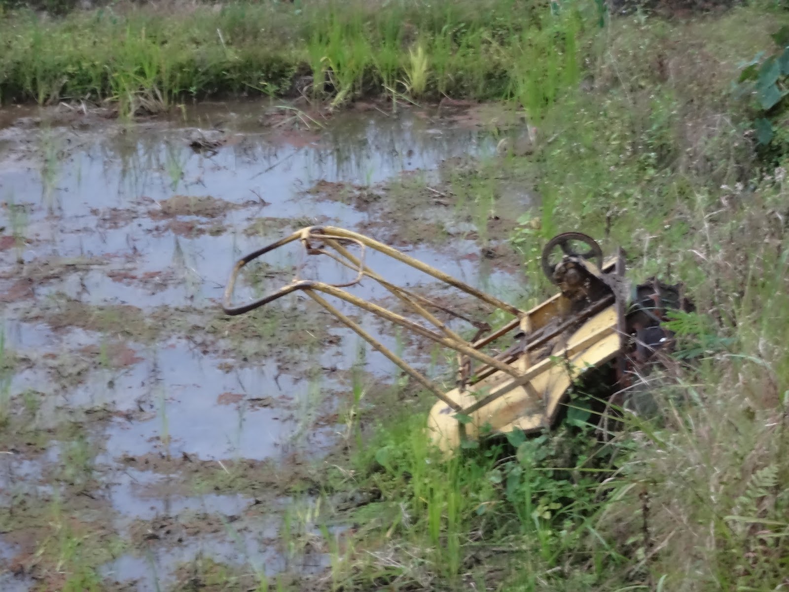 |
| the only machine seen during my trek |
Then rice is planted and germinated into a very small fields that can be well protected from rodents and bireds. When the plant is big enough the rice in then transplanted into the fields
 |
| rice before transplantation |
 |
| transplanted rice |
In some place the bunds of the terraces are used to plant onions, paksoi or beans.

 |
| beans on the bunds |
After the planting, the Ifugao hold a big festival where all the people from the different villages meet and enjoy the time after hard work and hoping for good harvest. Rice fields need to weeded from time to time, a typical woman's work and the irrigation well managed.
 |
| Irrigation of the rice fields is complex as it implies managing fields simultaneously |
In June is harvesting time, and then several steps are needed from harvesting to our plate, namely drying, storing, milling, and processing. The riceworld museum at IRRI (International Rice Research Institute) in Los Banos, gives a nice overview of these processes as well as IRRI's webpage (Rice production and processing)
In Batad, there is one cropping season for all the fields. Certain fields, that are located within the mountain in such a way that they don't get affected by the typhoon, mainly the fields around the village (that is build in the typhoon save area) are cropped twice.
Also, no fertilizers are used. Since there is no road, fertilizer need to be carried from far away making it too expensive. Also the people i talk to did not seem to want to improve much on rice productivity, it is staple food for the home, it does not bring cash so why should you invest in fertilizer? The positive side of the lack of fertilizer use is that the fields are full of shells, and some have fish ponds. These by-product of rice helps people to diversify their diets and get sufficient proteins at low cost. Would they use fertilizer, both shells and fish would not survive.
 |
| The cercle in the fields indicate location that are much deeper than the 10 cm water, where fish is kept. |
The rice production system I met around Batad, is not the most productive in terms of quantity of rice but seems to be a sustainable and well equilibrated system that support the people nutritional needs.
Wednesday, February 6, 2013
Working in water in Africa ? Join the competition!
 By Prof. Nick van de Giesen (Delft University of Technology, The Netherlands), guest writer
 Building no less than 20,000 weather stations across Africa; one very 30 km. That is the aim of the ambitious Trans-African Hydro-Meteorological Observatory (TAHMO) project, a joint initiative from Delft University of Technology (The Netherlands) and Oregon State University. In an earlier blog post we reported on this project from Mauritius.
Presently, the African observation network is very limited. National governments and regional planners do not have the data to make proper decisions regarding investments in water resources infrastructure. With an increase in quantity and quality of climate stations, we can move forward towards the goal of obtaining accurate climate data. This data is essential for agriculture (e.g. harvest predictions), weather predictions and climate modelling. Furthermore, the stations would be placed at schools and integrated in the educational program.
TAHMO is an ambitious and inspiring project but it still is in the initial phase; TAHMO is an extensive project with various aspects that need to be addressed before we can start building the observation network on the African continent. Topics that need to be considered go beyond designing and building the weather stations network. Also legal issues around the measurements, maintenance of the stations and expertise on how to integrate TAHMO in the education curricula are of high importance.
We are aware of the fact that for these issues to be addressed adequately, local experience is essential. Therefore, we are building a community around TAHMO, consisting of (African) individuals, universities, (scientific) institutes and other relevant organisations that are supportive of our project and are willing to think along with us on the various aspects of this grand project.
In order to take the first steps in building this community, the TAHMO Sensor Design Competition is being organised (deadline 1 March 2013, extension possible upon request) among African campuses, engineering societies, research centres and technology communities. The objective of this competition is to design a sensor that measures a weather or hydrological variable and is both inexpensive and robust, but also requires zero maintenance for two years. Among parties that have shown their interest in participation are the Bahir Dar University (Ethiopia), the University of Ibadan (Nigeria), the Kenya Polytechnic University College and the Ghana Institution of Engineers.
Of course, we would like to expand the TAHMO community as vastly as possible. We therefore would like to encourage everyone who is interested to join our community and participate in discussions on www.linkedin.com/groups?gid=4729379 or www.facebook.com/TAHMO.competition. More information on the TAHMO project and the competition can be found on www.TAHMO.org. Together we can make TAHMO work!

Initially this blog was meant as a place to report from development in rural areas around the world. I am therefore very happy to introduce the new label "guest writer" to my blog and proudly publish this blog post contributed by Nick. I hope this will motivate other to contribute to this blog too!
Friday, February 1, 2013
Nile Goblet a new open source tool for suitability analysis applied to rainwater management in the Ethiopian Blue Nile
This is my 100st post on my blog, and I kept this magic number to introduce the Nile Goblet tool to you, an open-source GIS solution, which is also the major output my two years work in Ethiopia.
Suitability analysis is a procedure within the geographical information systems (GIS) that identifies location where a given practice or technology is suitable. It is therefore an important tool for targeting interventions on the ground and develops context specific policies.
Suitability analysis is a procedure within the geographical information systems (GIS) that identifies location where a given practice or technology is suitable. It is therefore an important tool for targeting interventions on the ground and develops context specific policies.
The Nile-Goblet tool is an open source GIS software that allows
to perform suitability maps easily without any prior GIS knowledge once the
database is ready. Policy maker and practitioners
can input their knowledge about a given practice/technology and learn from
their maps. Because the mapping procedure is very transparent, users will
understand and trust the resulting maps. Hopefully this understanding will
allow to policy makers to move away from blanket approaches, and practitioners involve
with communities based on a set of option based on scientific knowledge that fit the context.
 |
| The user interface of the Nile Goblet tool |
Databases can be create for micro watershed, basins/regions
or countries. New maps can be added to the tool in ascii format with WGS84
geographic coordinate system. The manual coming with the tool show how to
prepare new layers in ArcGIS software or in Grass, an open source GIS software (http://grass.osgeo.org/) .
This tool has been developed for the Nile Basin Challenge
Program (www.nilebdc.org) and for the
Ethiopian context, where best practices for rainwater management are well known.
Nonetheless the adoption of many of these practices are still low, mainly
because they have been promoted in location where they are not suitable, or have
not been combined with synergistic practices that would result into real
benefits for farmers. Rainwater management practices therefore need to be
combined at landscape scale to form rainwater management strategies. To fit the
need of integrated watershed management, the Nile Goblet tool also allows to
combine practices at landscape scale.
 |
| The suitability map for mango created in the Nile Goblet tool |
The tool comes with a database, that includes all the freely
available layers for the Nile relevant to water management, as well as a sample of rainwater management practices which
suitability has been based on the “integrate participatory watershed management
guidelines” from the ministry of agriculture (check the guidelines https://docs.google.com/open?id=0B_BdeBrudKuydlN6WHVzSGE2aXc and https://docs.google.com/open?id=0B_BdeBrudKuyZjlRVHhYNEN6NjQ)
The tool has been tested during several trainings and
learning event and the major key players in water management in Ethiopia could
be reached out. All trainings were overbooked, and most
participants have welcomed the tool with great enthusiasm. Time will show if it will truly be taken up!
You want to test the tool yourself: check it out under
output and material.
Check out the NBDC blog post about this tool http://nilebdc.org/2012/12/18/thematic-working-group-technological-innovation-hosts-its-first-learning-and-training-event-for-the-benefit-of-the-whole-national-platform-on-land-and-water-management/
Check out the NBDC blog post about this tool http://nilebdc.org/2012/12/18/thematic-working-group-technological-innovation-hosts-its-first-learning-and-training-event-for-the-benefit-of-the-whole-national-platform-on-land-and-water-management/
Monday, January 21, 2013
Agriculture in the jungle
My search for a new adventure brought me to the Philippines : a place were rice means food security and has shaped the most amazing landscape with terraces and complex irrigation systems. I could not help going for a trek in the area of Banaue where these terraces are, inhabited by the Ifugao people .
The up-coming blog post series labelled Ifugao trip will give you a chance to discover this beautiful and interesting region.
Rice is not native to the the Philippines, it has been introduced about 2000 years ago. Before that Ifugao people were living on sweet potatoes, planted in the middle of the jungle. Still today when crossing the jungle to reach rice terraces, one can find these very little patches of agriculture on the steep slopes.
These patches are won from the jungle from the already deforested area with a slash and burn system. In some patches are divided in 3 and distinctively have a crop rotation : sweet potatoes, beans and fallow, sometimes also combined with banana on the boundaries.
Often the sweet potatoes is inter-cropped with cassava as well as (for me an unidentified) tree that produced edible bean suggesting that it is a nitrogen binding plant. Also sometimes one can finds fields where sweet potatoes and beans are intercropped.
Looking at this rain-fed system, it looks pretty sustainable. The patches used for agriculture are relatively small (there is a lot of untouched jungle left). There are areas that are left fallow, allowing the soil to recover. The biomass on the fallow area will be burned before planting crops. The burning increase the fertilization of the soil (in the short term) also the combination with both the green beans and the "bean tree" increases the nitrogen (=soil fertility).

Probably, the rice terraces, providing staple food and insuring food security has helped to keep the slash and burning system relatively limited still allowing for fallow patches despite of the increasing population pressure.

 |
| View from Banaue |
 |
| Ifugao people in traditional cloth (these very old ladies and gentlemen who cannot work in the fields anymore make some income from posing for tourists) |
Rice is not native to the the Philippines, it has been introduced about 2000 years ago. Before that Ifugao people were living on sweet potatoes, planted in the middle of the jungle. Still today when crossing the jungle to reach rice terraces, one can find these very little patches of agriculture on the steep slopes.
 |
| patches of agriculture in the middle of the jungle on the steep slope |
 |
| the sweet potatoes in front, beans in the back and the banana trees |
 |
| same farm than above (view in the other direction), the sweet potato field in front and fallow in the back |
Often the sweet potatoes is inter-cropped with cassava as well as (for me an unidentified) tree that produced edible bean suggesting that it is a nitrogen binding plant. Also sometimes one can finds fields where sweet potatoes and beans are intercropped.
 |
| The nitrogen binding tree in an inter-cropped fields with sweet potatoes and beans |

Wednesday, January 9, 2013
Land grabbing or development : a reflection from Mali
Recently i have reported from a new campaign, why poverty?. They produce short and long movies about controversial issues linked to poverty. What I like most, is that movies from this campaign are not polarizing, but trying to show the different stakes and sides from the problem.
I just watched the movie on "Land rush", and really liked the way the movie tries to show that direct foreign investment into agriculture in not per se a bad thing (also see http://catherinepfeifer.blogspot.ch/2012/11/land-grabbing-or-development.html). It follows an investor who tries to buy in the local population into the project, making sure that his project benefits to development of the local community. Have a look, it is a impressive movie showing the good side but also the turn downs of such big projects.
Basically the investor tries to plant sugar (that needs irrigation), each part of the sugar farm should be maintained by smallholders (whose land has been taken away) and who becomes agricultural contractors. A similar project seem to be a great success in Zambia, where people have been lifted out of poverty, as they earn now enough and get access to free health services and education.
However what i miss out of the discussion is a bit food security, not so much at local scale (as the contracted farmers would earn enough to buy food), but at global scale shouldn't we actually focus on grain production rather than sugar and try to get the world food price down for staple food? (see http://catherinepfeifer.blogspot.ch/2012/12/hunger-for-profit.html). The other point that is not discussed in the movie is water. Sugar cane is very water intensive. Where does it come from? is it sustainable? and how will the sugar project change the water access for the local population, both for the ones that buy-into the project and those who opt out?
And my last concern, how can we insure that the benefits that are given to the community are going to be there in the long term, or in financially difficult times? will the management of the sugar plant be participative? what will be done to avoid corruption?
But in general, I think it is a great try to make agricultural development based on market opportunities, allowing theses farmers to move away from their dependency on aid.
It makes me very sad to see that with the Mali Coup d'Etat, the sugar cane project lost all its support from the government and could not be implemented, whereas all the other investors that are truly land grabber just could continue. It is a missed opportunity to prove to the world that market based agricultural development that benefits to the communities is possible.
Subscribe to:
Posts (Atom)